Road Trip to Maine, Part 2
Tuesday, August 9, 2005
I stayed up until around midnight the night before reading "Two Wheels
Through Terror" by Glen Heggstad. It's his personal account of a
journey down to the tip of Tierra del Fuego and back, which included a
brief five week stint as a hostage of the ELN in Colombia.
Considering I've always wanted to do that ride, I found the book an
incredibly compelling read. Even with the late bed-time, I woke up
about 6AM ready to get a start on the day.
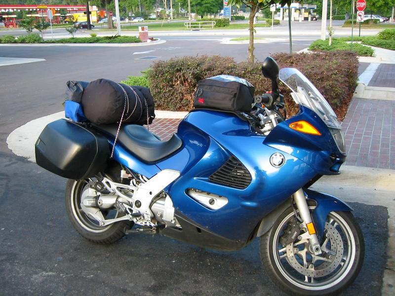
My itinerary consisted of one piece of business I had to take care of,
and then several things I wanted to do. After cleaning up I made my
way into Bar Harbor to find a caf� where I could have a suitable
breakfast. It was cool this morning, and I took the scenic route down
through NorthEast Harbor in to town.
Within five minutes of arriving in town, I found a little bakery on
Cottage Street which advertised that they had "Wild Blueberry
Pancakes." Although I'm not really a huge blueberry fan, I had
intended to enjoy many of the local flavors while on this trip, and
blueberries seem to be a major ingredient in everything.
The pancakes were absolutely first class, and relatively cheap. After
breakfast I wandered downtown to an ATM for some cash, and then
because my cell phone did not work in Bar Harbor, I went looking for a
pay phone.
Finding a pay phone, I put in a call to Street Cycles in Falmouth,
Maine. I had already scheduled an appointment with them for a new
tire before I went home, and I wanted to see if they could order a
replacement saddlebag and have it ready by the time I got there on
Friday. Ian, the guy in the parts department, said it would be no
problem, and even with the express freight it only cost $369.
After taking care of that, it was time to do the other things on my
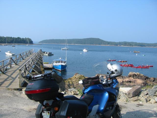
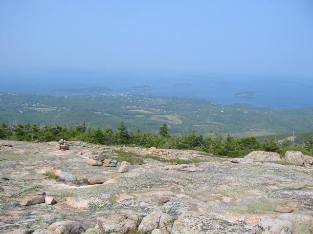
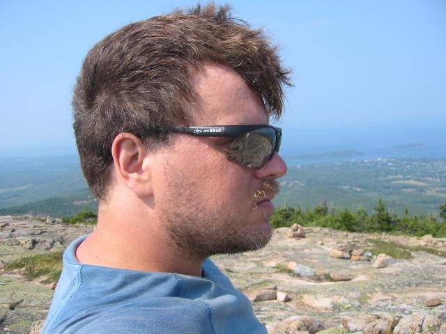
list. I left Bar Harbor heading south on 3 until I saw a sign for
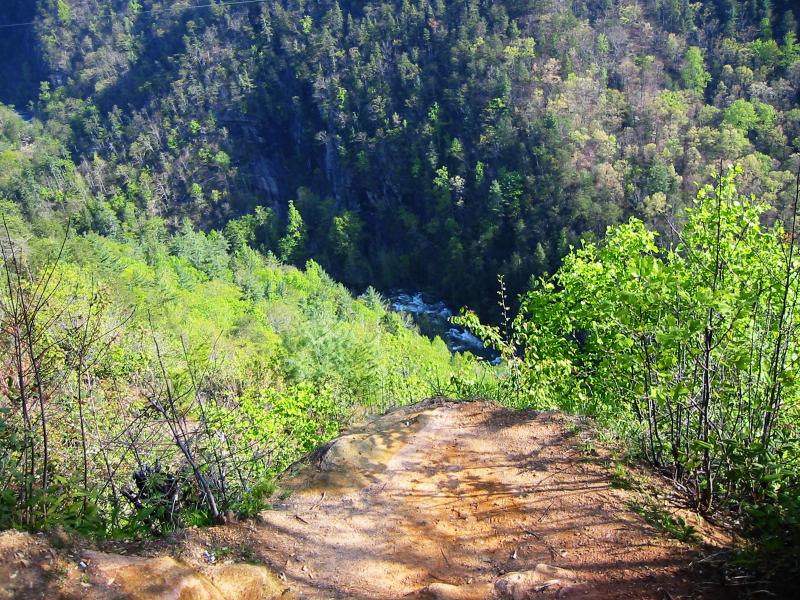
"Otter Cliff Road." This road took me into Acadia, and brought me to
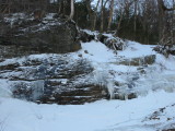
a hiking trail on the coast. I hiked the trail, which brought me over
a cliff along the shore, and shot a roll or two of film while
overlooking the Atlantic.
After that I continued on the Loop Road into the welcome center to pay
my entrance fee. Cars normally pay a $20 fee, but us motorcylists get
to pay the discounted hiking fee of only $5 per person in most of the
national parks, as long as you let the ranger know you're on a bike.
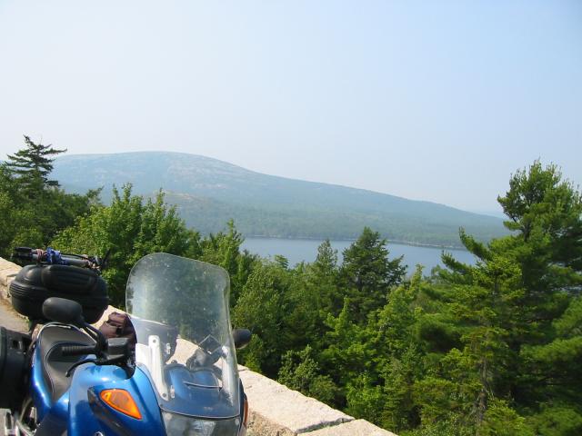
I then continued on the loop road down towards NorthEast Harbor,
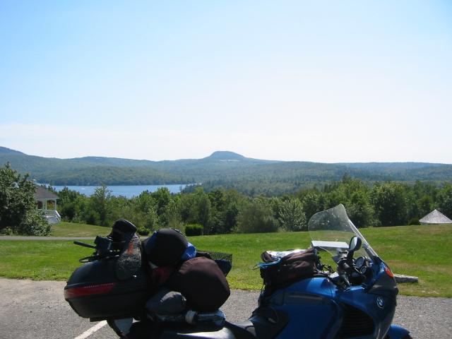
passing Cadillac Mountain, but getting a pretty good view of it.
I continued down on 3 and had lunch at the Light House Inn in Seal
Harbor. The lobster roll was excellent, and inexpensive.
With a full tummy, I decided to head north into Ellsworth to stop at
the Honawazaki shop. There was a pretty major scratch in my face
shield which had been bothering me, and I hoped I could find a
replacement Nolan shield there. Unfortunately, they were unable to
help, and so I made my way back onto Mt. Desert and down to the
SouthWest Harbor.
A brief aside. Mt. Desert Island is really two land masses, shaped
more like two individual lungs, or kidneys, joined together at one
strip on the northern side. This map
shows what I mean. The "NorthEast" harbor is really on the
southern end, but eastern side, of the eastern "lobe," while the
"SouthWest" harbor is on the eastern side of the southern end on the
western "lobe".
So, SouthWest is really SouthCentral, and NorthEast is really
SouthEast. Are we confused yet?
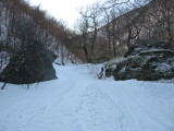
SouthWest Harbor is another small touristy town, but nowhere near as
built up as Bar Harbor. I continued on 102 through the SW harbor down
to the natural sea wall where I stopped and hiked for a bit.
While taking photos, I ran into a couple riding two up on a Suzuki
Boulevard with Florida plates. They looked like they might have been
retired, and the bike looked too small to travel two up from Florida,
but I asked them anyway.
"Hey, don't tell me you guys rode two up on that thing from Florida,
did you?"
"Oh god no, we strap it on the back of the RV."
"Ahhh, OK, where are you all from?"
"Ocala."
"Oh, I'm from Gainesville. What are the odds of riding 2000 miles to
meet someone who lives less than 40 miles from you?"
They told me that they were retired, and spent their summers traveling
around the country in the RV and that this was their first trip to
Mt. Desert Island.
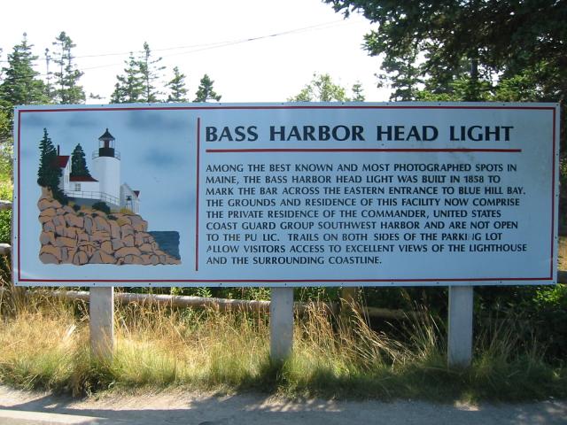
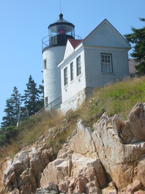
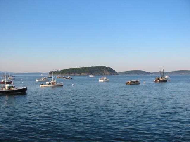
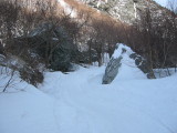
I continued on 102A down into Bass Harbor and the Bass Harbor
Lighthouse, and stopped for some more pictures.
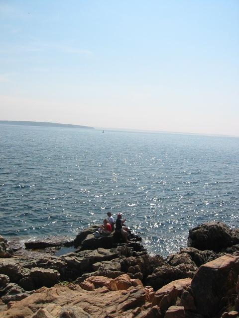
BTW, to get the shots of the light house, I had to crawl out over the
ocean to where these folks are standing:
After working up a pretty good sweat and sunburn at the lighthouse, I
went back to the campground and cleaned up.
After getting cleaned up I went to the Bar Harbor Bewing Company
for their openhouse tour and beer tasting. I was suckered into
stocking up on supplies which I had shipped back to the house, but I
found the beers to be yummy and the tour interesting.
I then made my way back into Bar Harbor and had dinner at "Rupununi"
on Main Street. Once again I had crab cakes, and they were
incredible.
With dinner completed, I walked into the town square and enjoyed
watching everyone interact and play. I felt inspired, and wrote a
brief fictional sketch of the scene.
This day turned out to be fantastic, the riding was good, the scenary
was incredible and everyone I met was friendly. It more than made up
for the mishap yesterday.
Mileage: 162/2558.
Wednesday, August 10, 2005
4:45AM.
Whaaa! Whaaa! Whaaa! Whaaa!
Damn, there's a baby in a neighboring camp-site and the parents aren't doing
anything about it. Hell, my friends got kicked out of a state park for making
1/4th the racket that kid's making.
Ugh, put ear plugs back in, go back to sleep.
Woke up again at 6:30. My sleeping bag was a bit damp from the
humidity, so I took it out and hung it up while I showered and got
ready for the day.
I was on the road by 9:15AM.
This time, I took 102 south to "Pretty Marsh Road." I stopped along
the way and shot half of a roll of film, and then continued to the
launching point for the Pretty Marsh Lake.
After that, I followed PMR to the west side of the island, where I
joined back up with 102. I followed 102 through West Trenton, and
went back down to the Seawall.
Although it was only around 10:30 in the morning, the western side of
the island was already in the upper 80s. When I got to the Seawall,
the cool atlantic air lowered the temperature to a more palpable 50,
or so.
I hiked along the coast for a solid hour, shooting film and watching
two gulls fight for a lone rock outcropping. The cold salt air cooled
my bones, and the sound of the waves crashing against the shore eased
my soul.
After my hike, I continued on 102A to 102. Between Bass Harbor and
West Trention is a small turnoff for the Bass Harbor itself. I went
into Bass Harbor and stopped at Island Astronomy, however they
were closed.
Although Island Astronomy was closed, I was fascinated because Bass
Harbor was more of what I expected to find in the various harbors
around Mt. Desert Island. The harbor was loaded with rusty old ships
stacked with lobster pots.
This was the sort of harbor I had been hoping to photograph, and both
camera bodies came out. Unfortunately, I didn't think to pull out the
digital camera...
When I had shot several rolls of film, I continued on 102 north until
I came across "Beech Mountain Road." I followed the road to the
parking lot, and saw that there was a 1.6 mile hiking trail.
Having learned from yesterday, I packed a pair of shoes today in my
saddle bags and traded my riding boots in for more suitable hiking
shoes. I started working my way up the trail, stopping for the
occasional photo.
The Beech Mountain trail was amazing because it started out very warm
and humid, but when you turned a corner that left you with a stunning
view, the cool atlantic air covered you with the best air conditioning
money could buy.
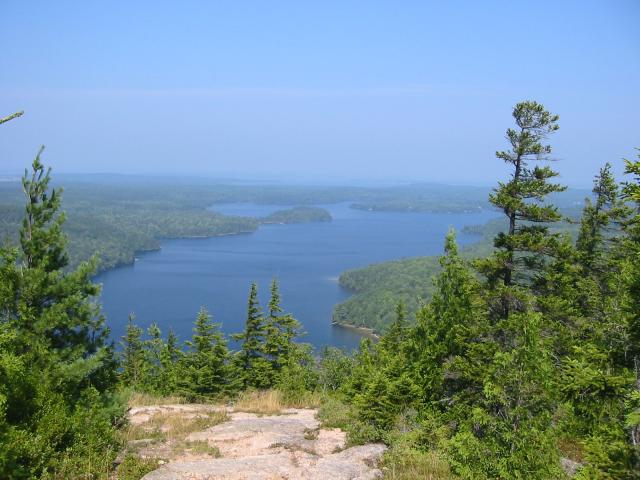
For the most part, the trail was fairly isolated and I only ran into
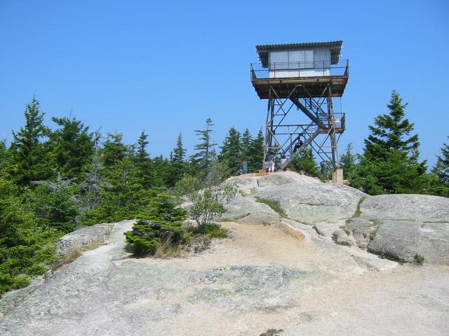
one or two other hikers until I got to the top of the mountain. At
the top, there was an observation tower with several hikers relaxing
before making the trek back to the parking lot.
When I was done with the hike, I worked my way into the SouthWest
Harbor, which is really on the SouthCentral part of the island, for
lunch. I decided to break from the seafood theme and went to "The
Downeast House of Dogs," and although the food was good, the service
was terrible.
With lunch done, I decided to go to the local internet caf�, "The
Mouse Pad," (isn't that cute?), and fire off a few quick emails. I
sent a note to Sandy, telling her how great Maine was, and then
another one to the geeks and bikers back in Gainesville. When that
was done, I decided it was time to go visit Cadillac Mountain.
According to legend, if you hike to the top of Cadillac Mountain right
before the sun rises, you can be the first person in the United States
to see the mornings light.
I don't know about that, but I do know that it is one of the biggest
tourist destinations for visitors to Acadia. Because of this, it was
packed to the gills with people and buses, definately not what I had
in mind.
There was a little 1/4 mile hiking trail from the top, which I did,
bumping and pushing everyone out of the way in an effort to find a
piece of privacy. Unfortunately, this trail was not the place to find
it.
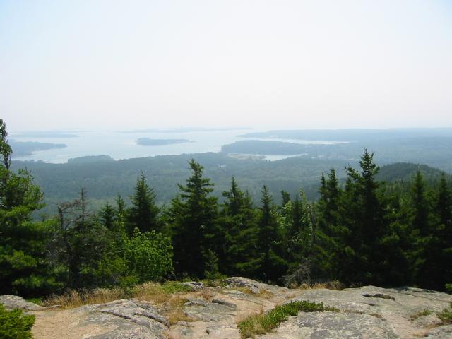
When I got back to the parking lot, I saw a sign pointing out another
2.2 mile hiking trail. Well, if nothing else, maybe it would be a
little less crowded.
This particular trail was on the North East side of the mountain, and
afforded a pretty good view of Bar Harbor below.
I found a lone outcropping, and sat down for awhile and collected my
thoughts. Here was a place I was able to find peace and quiet, away
from everyone and everything.
Work was 2,000 miles away.
School was behind me.
Even the cracks in the bike were not an issue.
I found peace.
After the hike, I went up to Ellsworth to visit the Wallymart and see
if I could get something that might buff the scratch in the face
shield out.
While in the parking lot, one of the straps for my tankbag broke.
Aye, what else could go wrong on this trip??
I repaired it with a zip tie, then continued on into town. Although
it was annoying, I had been shopping for a replacement bag anyway, and
this just gave me the opportunity to get off my cheap-skate ass and
get a new one.
After my visit to Wallymart, I stopped for dinner at Lunts Lobster
Pound, which is on 230 in Trenton, right between Ellsworth and
Mt. Desert Island.
Lunts is an amazing place. It was built in 1930, and really has that
small town, everyone knows your name, kind of atmosphere. There is a
communal sink to wash up after you're gorged yourself on shellfish out
back, and there were picnic tables where families and friends could
gather for a meal under the shade of a tree.
I ordered the Lobster Dinner, and it was $14 with two sides. One tip,
they don't give refills on sodas, but they will for tea. Like most
places north of Virginia, they don't know what sweet tea is.
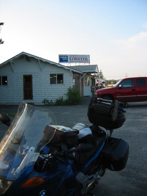
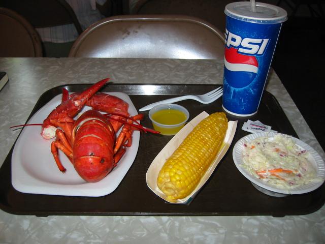
The total bill, with tip, the soda, and tax, was less than $18. And I
was stuffed.
After dinner, I went back into Bar Harbor and walked around for a bit.
Knowing that it was my last night on the island, I decided to find a
caf� and have a piece of blueberry pie.
I stopped at Donohue's, which is also on Cottage Street, and for about
$10 I had a slice of yummie pie a-la-mode and a Bar Harbor Real Ale.
The hostess was incredibly friendly, as most of the people I met in
Maine were, and she didn't act like "oh god, I've only heard that
question a gajillion times" when I asked her about living with the
winters.
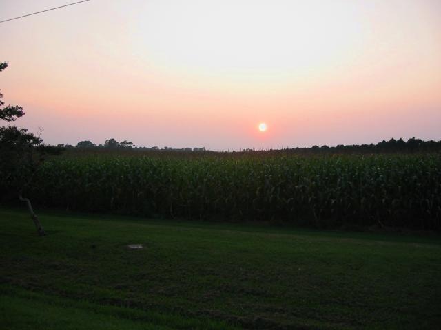
On my way back to the camp-site, I caught one of the most spectacular
sunsets I had seen on the trip.
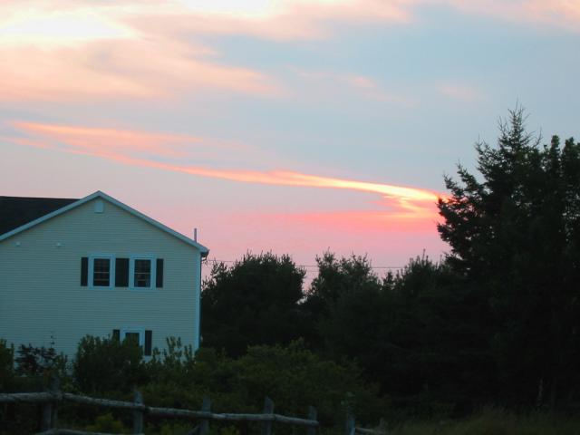
It was a fitting end to my stay on Mt. Desert Island.
Mileage: 122/2680.
Thursday, August 11, 2005
The kid woke me up early again, but I guess someone must have
complained to the camp staff because within five minutes I heard their
car leave and then silence. I got up at 6:00AM, broke camp, and was
on the road by 6:40.
My planned route would take me into the interior of Maine, and then
back to the coast by Portland, where I had a service scheduled for
Friday.
This morning was different from the others I had experienced so far on
my trip; US-1 was fogged in and the temperatures were cold. Now, this
is more of what I expected from Maine..
I took US-1 into the town of Belfast, where I then hopped on 137. 137
was a pretty decent road, and the fog broke while I was riding it. I
made my way to Albion, where I jumped onto US-202.
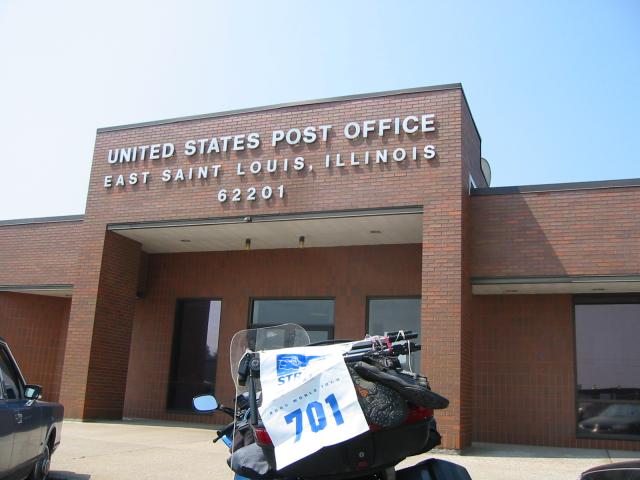
When I got to Augusta, although I had planned to pick up an A in
Auburn, I thought about stopping at the post office and grabbing it
there. Unfortunately, the post office in Augusta only says that it is
the "Edmund Muskie Federal Building," so I continued with my original plan.
On the way to Auburn I stopped at a large Harley shop and looked
around. I was really surprised at how well stocked they were,
especially considering that the riding season in the interior of Maine
has got to be very short.
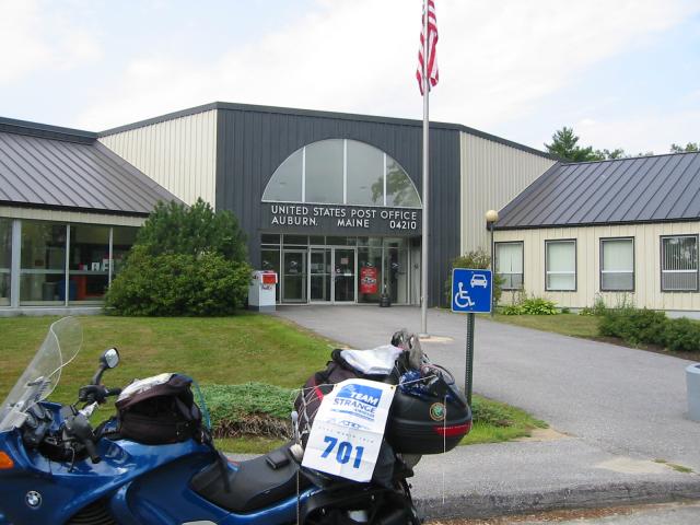
Once I got into Auburn I realized that it was a bigger town than I was
expecting, and without my GPS (which died, remember?), I wasn't
entirely sure how I would find the post office.
But, being the resourceful guy I am (and bashful and modest too), I
stopped at a gas station for directions. Asking directions is a novel
concept, but I found that although the attendant did not have a clue
where to go, he had a map on the wall which showed me the way.
With fresh directions in my head, I made my way to the post office and
the mighty A.
After completing that order of business, I continued on 202 into Gray,
where I jumped on 100 towards Portland.
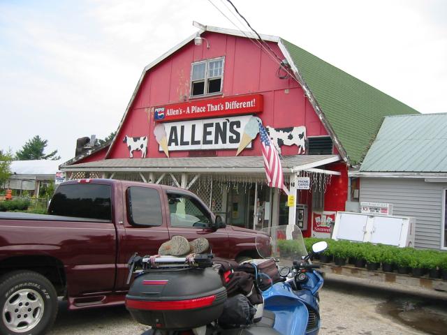
Having skipped breakfast, and 11:30, I was pretty hungry when I drove
past Allen's, a place that's truly different. It's a gas station.
Convenience store. Restaurant. And gardening supply place, all
rolled into one.
You can even buy a real officially licensed Larry the Cable Guy
"Git-R-Done" hat at Allen's.
I went ahead and stopped in for lunch, and ordered a burger and fries.
Let me warn you, if you ever stop there for lunch, be prepared to
share the fries with a small country because they are anything but
stingy. They brought me an entire plate packed with the things, and
then the burger.
I tried my best, but I could barely dent all of the food, and I
reluctantly had to throw it out.
After the lunch, I continued on 100 into Portland, and went downtown
to get my bearings. My appointment was in Falmouth, which was about
10 miles north of where I was. Additionally, my cell phone started
working and I had a message from Ian saying that he had received the
saddle bag and it was ready for me.
I went ahead and went north on US-1 into Falmouth, where I found a
hotel. I checked in and proceeded to do some laundry and then went
out for a one hour hike around the area.
After my hike, I made a few phone calls to family, then had dinner at
"Ricettos". I enjoyed a Harpoon IPA draft, and then walked back to
the hotel.
Shortly after getting back, I got a call from Tim saying that
sport-touring.net was down, and that the site owner was trying to
track me down because I had been playing the role of sysadmin there
for the last six months or so. I told Tim I was in Maine, nowhere
near a computer, but to have Neal call me if he still needed help. I
also recommended contacting Mike L. from Salt Lake, since he probably
had access to a computer and could help.
After the call, I met and started talking to another lone traveler.
His name is Don Estes, and he's from Long Island and was riding a
Wingding. We chatted for a bit about riding, he was heading up to
Nova Scotia, and I was about to head home.
Finally, it was time for him to go to lunch, and I went into the room
and continued to read Glen's book.
Mileage: 189/2869.
Posted at: 20:15 on 19/08/2005
[ / ]
#
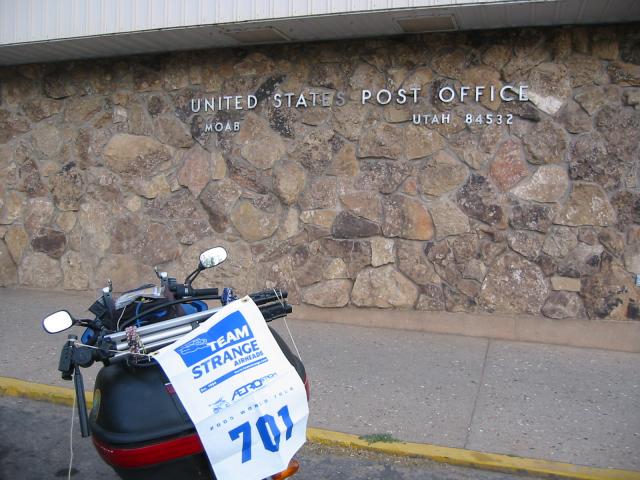
ESTN 2005, part 1
In May I signed up for the Team
Strange 21st Anniversary Grand Tour. According to the rules of
the tour, I must visit individual towns that start with letters which
could be used to spell the phrase "TEAMSTRANGE AIRHEADS" and then a
route 21. Each town could only be used once, and I had to provide
photographic documentation that my bike had actually made the trip.
Not being satisfied with taking the easy way for anything, I also
decided to tackle the Dave McQueeney challenge, which requires that
each town visited be in a unique state; each town and state could be
used only one time.
In June I visited the Sport-Touring.Net national
rally, which allowed me to rack up a number of states. However, I
still needed a few final letters, and I used the idea of a ten day
trip to Maine to celebrate graduating college as an excuse to finish
the tour. During the trip I burned my buns, met up with some friends
for a rally, finished the tour, drank some beer and fine scotch, and
ate some bugs (crustaceans).
This is the story of that trip.
Thursday, August 4, 2005
The plan was to meet up with various members of sport-touring.net in
Fairmont, WV, and then we would all ride to Stowe, Vermont for the
Eastern Sport-Touring.Net rally as a group on Friday. My
last final was scheduled for 9:30AM on Thursday, August 4th. I showed
up to work with all of my gear loaded on the bike, took the final, and
was ready to leave Gainesville an hour after the final began.
My route took me up to US-301 through the speed traps of Waldo,
Starke, and Lawtey. I hit I-10 close to 11:30, and the temperature
was already approaching the high 90s, but considering I had just
finished school I was feeling pretty good. The Eagles came on channel
46, and I launched onto the on-ramp just as Don Henley began crooning
about living life in the fast lane.
I continued on I-10 east to Jacksonville, where I took I-295 north to
95. It started to rain a little bit on I-95 just south of Savannah,
but I was happy for the chance to cool down from the heat. In South
Carolina I jumped onto I-26, then I-77 through Columbia.
Although I was making decent time, I managed to hit Charlotte right at
rush hour. With the construction on I-77, traffic slowed to a crawl
and I easily lost 30 minutes from my pace. On top of the traffic, it
was easily 98 or 99 degrees, and even with my camelbak I felt the heat
ripping me to shreds.
As I was crossing into Virginia, my phone started to ring. It was a
buddy of mine who is currently looking for a Honda 919, and he wanted
to ask me some questions about one he found. He asked where I was,
and I explained that I was doing 70 on the interstate crossing the
NC/VA state line.. I guess the starcom was acting up because he
mentioned it was making a little background noise.
Thankfully, the Virginia mountains were substantially cooler, and it
helped bring my core temperature back down.
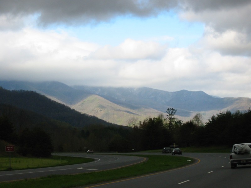
In Beckley, WV, I got off of the interslab and took US-19. US-19 in
West Virginia is a decent four laned highway which takes you over the
New River Gorge. As the sun was falling, I got a splended view of the
Appalachians at sunset.
I continued on US-19 to I-79, and then took 79 North. This stretch of
79 is surprisingly twisty, and I had to keep checking my speed to make
sure I didn't out drive the lights on this road.
I pulled into Fairmont around 10:45PM, and was told by the front desk
clerk that the others had already arrived and left me a key while they
went to dinner. Five minutes after my arrival, Allen, Mark, and Tim
arrived bearing gifts of beer. Sean was not in yet, but Allen
received a voice mail saying he was on his way and was caught in
construction on the western side of WV (I-79).
After having a few beers, we decided to call it an early night. We
requested a 5:30AM wake-up call, and left the door unlocked and
slightly ajar so Sean could stumble in when he arrived. It was
midnight, and for the day I had ridden 806 miles.
Friday, August 5, 2005
Beep-Beep-Beep-Beep-Beep-Beep
The alarm clock was going off. Damn, I didn't remember setting it,
neither did Allen. I looked down at it and said to myself, "WTF?!" as
I saw it blinking 4:30AM. Apparently some cruel and unusual person
left the alarm clock set for oh dark 30 when he had inhabited this
room.
After figuring out how to turn off the alarm, I went back to sleep.
5:50AM, my circadian rhythm kicked into gear and woke me up. Wait a second,
weren't we supposed to get a 5:30AM wake-up call??
I woke up Allen who promptly uttered an expletive to describe his
dismay at the time. He took it upon himself to wake everyone else up,
and explain that we must get on the road ASAP -- we had to arrive at
the Smugglers Notch State Park by 8PM, or we would be unable to check
in for the evening. We had fourteen hours to go 750 miles, with a
group of five riders; the mileage wouldn't be so bad for one or two,
but group rides are always difficult to keep on track for a decent
pace.
We tracked down Sean, who had checked himself into another room so he
wouldn't disturb us, and started working on packing everyone up. We
were able to hit the road by 6:40AM, which left us with just a little
over thirteen hours to go. The front desk guy apologized for
forgetting to turn on the wake-up call, but what was done was done.
Tim was volunteered to lead the way, and he punched the destination
into his GPS and let it handle the routing. We took I-79 to I-81,
then 81 into Maryland and Pennsylvania. We stopped in Cumberland for
breakfast around 9:30, and while pulling into the parking lot I
realized I had just finished a saddlesore 1000 (1007 miles in 23
hours). After breakfast we continued on I-81 through the town of
Carlisle, up to 78 and ultimately Allentown.
We continued on 78 into New Joisey, and stopped in Bloomsbury to get
gas. Surprisingly, the legislators in New Joisey must have no faith
in their constituants because it is impossible to take a left turn, or
pump your own gas. Instead, the rule is that you must take a right
turn, then perform a u-turn, if you wanted a right. It took us 10
minutes to figure this out, and then we lost additional time when the
station attendant wouldn't let us fill our own bikes. The guys on the
ST1300's mentioned that it was already 98F, damn when would I finally
be away from the heat?? I was starting to feel heat related edema and
a little bit of a headache after the last two days of baking in the
sun.
All told, the New Joisey gas stop took us about 45 minutes. None of
us were impressed with the state.
We continued north on 78 up to 287, and then took the NY Turnpike (87)
up to Albany. Along the way to Albany, we got sucked into a horrible
rainstorm. Although it only lasted about 15 minutes, visibility was
dropped to near zero and my "waterproof" GPS leaked water and stopped
working. At least the rain cooled down the roads..
We arrived in Albany around 5PM, but found ourselves stuck in rush
hour traffic. On top of that, there was a car broken down up ahead
and one lane was shut down.
It didn't look good, but I called the campground and pleaded our case.
They agreed to let us check in up to around 8:15PM, but we still had a
ways to go and quite a bit of traffic to contend with.
Once we got past the airport, we were able to break free from the pack
and Tim set a blistering pace to make up for lost time. We continued
up 87 to the Schroom Lake exit, and went up to Crown Point where were
crossed Lake Champlain into Vermont. We continued through Burlington
to VT-128, then 104, and finally 108. Coming from the north, we rode
through the Smugglers Notch, which considering it becomes a one lane
road with no room for a car and a bike to pass head on, makes it a
pretty interesting section of road. We arrived at the state park at
8:15PM; I had just completed a little over 1550 miles in the 34 hours
since leaving Gainesville.
After setting up tent, we went into Stowe to grab dinner. The
restaurant we choose was extremely expensive, and the meal was not
worth mentioning. Discouraged, Tim, Mark, and I went back to the
campground while Sean went to meet everyone else at the official
lodge.
Once arriving at the campground we met up with the Canadian crew
(Corbeau, Richard, and Ben), along with Troy, the guy I was sharing my
camp-site with. Troy related an amusing story about trying to check
in before my arrival, and explaining how he had never met me, knew
what I looked like, or knew my last name. However, because I had
already let the park know I would be sharing the camp-site, they let
him check in without too many troubles.
That evening we stayed up until a little past midnight, enjoying the
fine company, plus the libations of single malt, port, or beer,
depending on the preference of the individual. Many lies were told
about various exploits, but we all still went to bed pretty early.
Saturday, August 6, 2005
My body told me to get out of bed at 6:30 and go take a shower. I
fought the urge as much as possible, arguing with myself while
explaining that I was on vacation (damnit), and did not need to wake
up early. I eventually lost the argument, and got out of bed at 7 to
take a shower.
Although I felt we were pretty quiet, apparently we made so much
ruckuss that no one camping next to our sites heard us, but the ranger
still asked the Canadians and the group I had ridden up with to leave
within 20 minutes, all while I was taking a shower.
The ranger claimed he had received "over seven" complaints about the
noise made from bikes running up and down all night long, as well as
the laughing and carrying on. He even claimed to be sitting outside
the camp-site, listening to us make noise well past 1AM.
Yeah, those ST1300's really do make an awful lot of noise, and why
would he sit and listen while a "rowdy bunch of bikers" disturbed
everyone else, rather than just come up to us and ask us to tone it
down .. Besides, we all went to bed by 12:30 from exhaustion, so I
wasn't buying the "1AM" story.
Regardless, although my camp-site was not evicted, I believe in
solidarity, and these were the guys I had come up to hang out with, so
I decided to leave too. While packing up my site, I asked some of the
neighboring campers if they heard any noise, and they all denied it.
Only one person said he heard a noise, and he happily admitted he
complained about it. Considering the manner in which he extolled how
proud he was of his achievment, I suspect he embellished a bit to the
ranger.
We wound up moving to a campground just south of Stowe on 100, but
they didn't open until 9. We used the opportunity to grab breakfast
at a little caf� downtown, which is when I discovered how good
blueberry scones can be. These things were not scones in the
traditional sense; they were clumbs of blueberries held together with
just enough dough to shape them into a clump, and boy were they yummie.
After breakfast, we got checked into the new site. Some of the guys
wanted to go to Maine, others wanted to go to the Kankamagus in New
Hampshire. Because I had the rest of my trip planned on my SP3, I
really wanted to see if I could revive it.
Tim hung out with me while I disassembled it with my leatherman. Sure
enough, there was about a table spoon of water in the unit, but I was
unable to make it fire up again. This really bothered me because I
had my final four destinations for the grand tour, plus a number of
breweries and lobster pounds plugged into it for the Maine portion of
my trip. Although I lost the waypoints, I had printed out the
addresses for the four post offices I intended to visit, and the first
one was near Stowe.
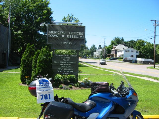
Tim decided to tag along with me, and we headed off to Essex, Vermont.
Unfortunately, the post office in Essex does not list the state. When
I asked the lone postal employee working in the center about this, she
went above and beyond the duty of any government employee and told me,
"so?".
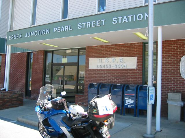
But, she did say there might be another post office down the road, and
proceeded to give me directions to a UPS store. That wouldn't have worked, but on the way I found a municipal office sign which should.
With the E out of the way, we took 116 south to 17, then 17 through
Sugarbush. 17 is a pretty nice road, with some decent curves, but one
thing I quickly learned is that many north eastern roads have little
furrows in them, called frost heaves, which can make travel on two
wheels entertaining. But the telelever absorbed it all, and life was good..
After riding 17, we took 107 to 110, and worked our way back to Stowe.
Tim and I went to dinner at a decent little sports-bar, and one of the
waiters came by to talk with us about our bikes. He kept talking
about his Aprilla, and how much fun he has riding it three months a
year, and he clued us in on some of the better roads in the area off
the beaten track.
After dinner we went back to the campground and met up with the rest
of the gang. Corbeau's wife came down from Ottawa, bringing Cadbury
the wonder dog, along with very important camping supplies (beer,
scotch, and ice). This night we stayed up well past 2:00AM,
discussing issues of serious importance like the application of
Kantian theory towards the war on terror, and the rising price of gasoline.
Total mileage: 221 for the day, 1767 for the trip.
Sunday, August 7, 2005
Most of the people in our group decided to boogie home Sunday morning,
but we all went out for breakfast first. Afterwards, Tim, Sean, Guy,
and myself decided to ride over to New Hampshire and ride the
Kankamagus in the White Mountain region.
Following the directions the waiter had given us the night before, we
took 100 north to the town of Eden Mills, where we hopped on "North
Road" (or "Eden Mills Road," depending on who you ask). This road
turned out to be a gem, with some nice gentle sweepers, and fresh
asphalt lacking frost heaves. We followed it north to 58, which put
us near the Vermont/Canadian border, a place where most tourists seem
not to dwell. Then we took 58 to 5A. We took 5A to 105, which we
followed to US 3, southbound.
While heading south on US 3, we stopped in Groveton for an overpriced
lunch of burgers and fries before popping onto 110. 110 in New
Hampshire is a great little road, it crosses over the northern portion
of the White Mountains, but is far enough north of Conway that there
is zero traffic on it. Once we crossed the range, we headed south on
16 through the rolling parking lot.
When we met up with 112, we took it over the Kancamagus Pass to I-93.
Because we were running short on time, and Sean had to pack up his
stuff and leave Stowe that afternoon, we took the fastest route and
followed 93 past the "Old Man of the Mountain," who has recently lost
his nose, to US-2, then 2 to 15 and 100.
When we got back to Stowe we had dinner at "Pie in the Sky," which
turned out to be the best, and least expensive, meal for the entire
time we stayed in Vermont.
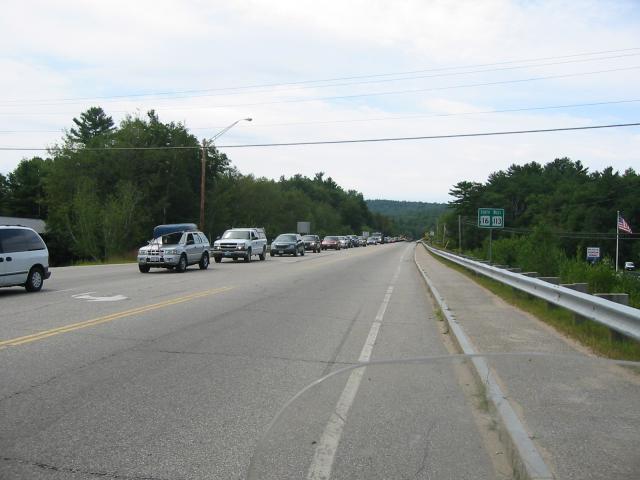
Although the Kancamagus had potential to be a fun road, it was so
backed up with the weekend yuppie traffic that trying to avoid being
creamed by a guy in a SUV chatting on his cell phone really detracted
from the ride. Personally, I preferred route 110 quite a bit.
Mileage: 311 for the day, 2078 for the trip
Monday, August 8, 2005
Sean had left the night before, so at this point it was just Guy, Tim,
and myself hanging out in Stowe. Tim had to return to work, Guy was
supposed to go to Portland to visit his relatives, and I was headed to
Mt. Desert.
We all went to the Green House and grabbed a quick bite. During
breakfast, Guy and I decided to ride together into Maine, and when we
were finished, we wished Tim a safe ride back to Michigan and
proceeded east.
Our plan to get into Maine was to ride north of the traffic jam in New
Hampshire, and shoot across US-2. From there, we would split up
somewhere in Maine, with myself going Downeast and Guy going south.
We left Stowe heading north on 100 to 15A, and took that to 15. We continued
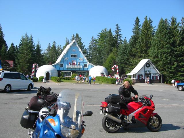
east on 15 to US-2 and shot across Vermont into New Hampshire. In Jefferson
we stopped at the world famous Santas Village to take pictures of the
utter weirdness.
We continued on into Maine, and were promptly greeted with 20 miles of mud
road the minute we crossed the state line. Not being one to shy away from
a little off-road, we continued east bound, but my reserve light came on
within a mile of crossing the state line.
This stretch of US-2 was very remote, and passing through the town of
Gilead I began to wonder if I would be able to find a gas station
before running dry, but Bethel proved big enough to have a station and
we filled up there.
We stopped for lunch at a little place called "On Top of the Hill"
just outside of New Sharon, and when I came out I found my bike lying
on its side. Some of the right side fairing was cracked, and the
right side saddlebag wound up getting destroyed because it was
dislodged from the mountaing brackets and rubbed into the rear tire.
Guy split off to go to Portland, and I decided I needed to call my
insurance company, so I made my way towards Bangor, where my cell
phone would work.
Although I was annoyed about the damage to the bike, the ride towards
I-95 kept taking me through beautiful forests and soft rolling hills.
The geography of the region is interesting; the mountainous regions
were formed from block uplifting of the underlying strata when two
continental shelfs collided, but then over several millenia, glaciers
scrubbed down the ridges as they pushed moraines through the region.
As the glaciers melted, the moraines were deposited as large smooth
boulders scattered throughout the region.
From New Sharon I took 137, which turned out to be quite a decent
little road with zero traffic, to 95. I followed I-95 north to
Bangor, where I filed a claim with my insurance company. They wanted me
to get a quote on the repairs as soon as possible, so I cancelled part
of the trip which would have had me working for a day in Vermont so that
I could get home a few days earlier.
After that unpleasantness was done, I continued on 1A into Ellsville.
The sun was blazing and according to several signs I saw on the way,
the weather was between 95-100F.
Once arriving in Ellsville, I bopped onto 3 and made my way to the
Mt. Desert campground where I had reserved the last available spot two
weeks prior to heading north. After setting up my tent, I hopped in
the shower and cleaned up before heading into Bar Harbor for dinner
and site seeing.
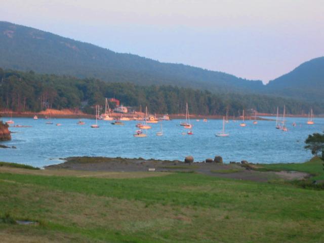
Bar Harbor survives because of the tourism industry, however it's not
annoying in the presentation. There are a number of gift shops, outfitters,
restaurants, and the like surrounding the bay. I walked around the harbor
and shot a roll of film, focusing mostly on the ships in the bay.
I had dinner at the Fish House Grill, which is right on the corner of
the pier. Although it was probably one of the most expensive places
in Bar Harbor, it was substantially cheaper than anything I had in
Stowe.
My waiter was not a particularly jovial fellow, and he reminded me
quite a bit of Kathy Bates' character in the film Misery. However, at
his suggestion, I enjoyed two local brews, the Bar Harbor Real Ale and the
Bar Harbor Blueberry Ale, along with my dinner of crab cakes.
After dinner, I meandered around the downtown zocalo, watching the families
with kids playing in the park. Several of them were enjoying ice cream,
and it looked quite good, so I fought my way into the line at the shop
and ordered a scoop of the soft serve blueberry. It was divine.
Mileage: 318/2396
Posted at: 13:27 on 19/08/2005
[ / ]
#
Mon, 27 Jun 2005
My trip to the 2005 Sport-Touring.Net National
Since its inception, I have attended every sport-touring.net national rally
that has been held.
On top of being the computer operations manager for my department, I
am also a student finishing up a B.A. at the University of Florida. I
am supposed to graduate this summer, but in order to do that I need to
take courses in both summer A and B. This years rally was held in
Montrose, Colorado on June 22nd and 23rd, which fell smack dab in the
middle of the break between the summer A and B terms, and I was not
going to make this year the first year I missed the meet.
My last final for the summer A term was held on Friday the 17th at
high noon, so my departure would be delayed until after the exam was
completed. Because I knew there would be some high mileage days
needed to make the round-trip within my alloted time frame, I decided
I needed to break up the monotony of the road with a diversion. The
Team
Strange 21st Anniversary World Tour provided a perfect diversion.
The basic rules for the Grand Tour are that I must stop at various
different cities, one per state, and the first letter of the city
should help spell the phrase TEAM-STRANGE AIRHEADS, and then find a
Highway 21 in an unused state.
Highway 21 in Florida is about 15 miles from my house, so that was one
of the first ones I knocked off the list. I've also gotten letters in
Kentucky, Tennessee, and Georgia from a previous weekend excursion.
That left me with 16 or so letters, and until October to complete the
phrase, and the route I planned would allow me to pick up thirteen
cities towards the Dave McQueeney award. Besides, I figured as hectic
as my work and school schedule have been, I'll need someone to come to
my house and mow the yard.
June 17, 2005
I left Gainesville after completing my final around 12:30. My route
took me along I-75 up to the I-10 junction just north of Lake City,
then I-10 to exit 130, U.S. 231. Once on 231 I took it up to
Montgomery, where I promptly discovered why I really didn't want to
get stuck in Friday night rush hour traffic in Montgomery. Heat,
humidity, and gridlock were the name of the day. A sign said it was
95F, and I believed it.
After getting through Montgomery, I worked my over to Selma along
US-80. Selma was one of the crucial locations during the civil rights
movement in the 1960s. In 1965 some 600 civil rights marchers headed
east out of Selma, towards Montgomery along the same route I had
taken. The civil rights marchers barely crossed the Edmund Pettus
Bridge, which leads into Selma, before they were beaten and attacked
by the local "lawmen".
My journey over the Edmund Pettus was quite a bit less controversial,
but I found the ride along U.S. 80 to be interesting nonetheless.
At Selma I got an S, but unfortunately the Selma Post Office
makes it difficult to prove the location by only listing the city and
state on the door of the building. I got creative
though, and used the reflection in the door to prove my bike was
there without the use of a trailer.
I don't own a car (or truck, or van), but even if I did, I couldn't
understand why someone would trailer their bike in a scavenger hunt.
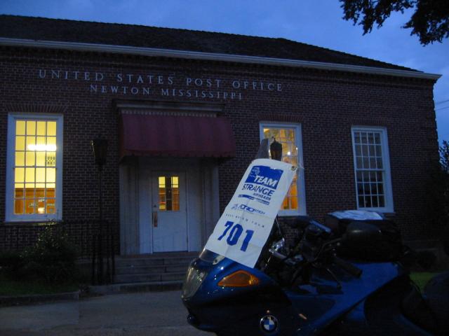
After grabbing the photo in Selma, I headed into Missississississippi
(hey cue a Fish Called Wanda and my name is K-k-k-k-ken). I took I-20
to the bustling metropolis of Newton, MS where I
promptly got an N.
As soon as I hopped off the bike to grab the photo, I threw away the
hookup cord which connects my starcom to my helmet. I'm not really
sure what I was thinking at the moment, but in retrospect it probably
meant it was time to call it a night, and that's what I did. I
figured for the rest of the trip I could just use the PS-2 extension
cable I routed in the bike to extend the socket anyway.
With my N in hand, I went and checked myself into the nearest hotel
and called it a night. It was 9:30PM EST (all future times will be in
EST), and I had just finished 537 miles and two letters.
A lot of negative stuff had been piling up in my life, and I could
feel it starting to slip away. The road is good that way.
Saturday, June 18
During the Memorial Day Weekend a friend of mine was in a real bad
head-on collision with another rider on the Cherohala Skyway. His
pelvis was shattered in many places, and the other rider lost part of
his leg. My friend lives in Jackson, MS, and had been flown into a
rehab center there from Asheville on Thursday the 16th.
When I first started planning the route, my plan was to stay with him
in Jackson, but after the accident, while he was convalescing in
Asheville, I forgot about it. When I realized that he was going to be
in Jackson while I was riding through, I decided to pay him a visit at
the rehab center.
The only problem was when I left Gainesville, I still hadn't found out
where he had been moved into. However, I had the phone number for a
friend of his who also lives in Jackson named Mark, and I made
arrangements to meet up with Mark for breakfast at the Pearl Cafe in
Pearl, MS.
The Pearl Cafe is one of those small town southern diners that are
just a jewel when you find them. It's one of those places where the
good old boys gather around for coffee and jawing on any given
Saturday morning. There were about seven or eight guys sitting around
a table talking about politics, or whatever, but when I walked in
decked out head to toe looking like a First Gear advertisement, they
became very quiet and began to eye me suspiciously.
After the waitress came out and took my order, they seemed to loosen
up a bit and resumed their conversation. Mark showed up while I was
enjoying my eggs, and after we both finished he took me to the rehab
center.
I spent an hour or so visiting with Mac, and his spirits seemed pretty
good. He's going to be in rehab for awhile, but he wants to ride
again so he's motivated to get working on it.
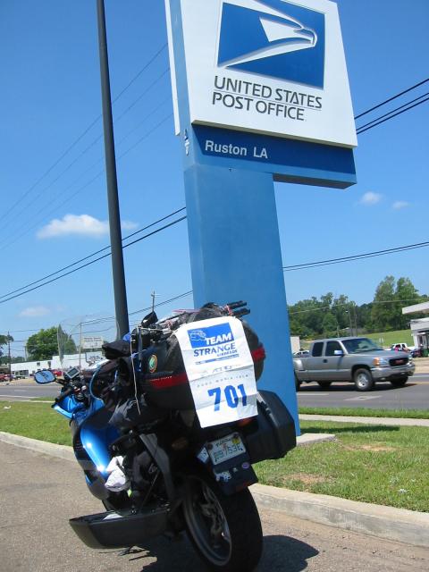
I left Jackson around 9:30AM and continued on I-20 West towards Ruston, LA for
an R. While leaving Jackson I hit a bump on I-20 and the starcom
power lead jiggled loose. When I stopped for a break I was able to
fix it again, but it was still intermittent until Sunday morning when
I was able to do a better fix on it.
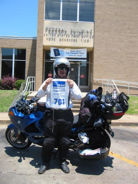
From Ruston I took 273 into Arkansas, and I stopped in Hope for an
H.
As you probably know, Hope is the hometown of Bill Clinton, who if
nothing else was one of the most interesting presidents we've had in
the last fifty years. People either love him, or hate him, and I'd
bet if he could run again he'd probably get elected to a third
term.
Hope seems like a pretty friendly place. The gentleman who took my
photo apologized to me for the heat wave, as if he had any real
control over the weather. I appreciated his sentiments though, but I
explained that living in N. Central Florida heat becomes one of those
constants you get used to.
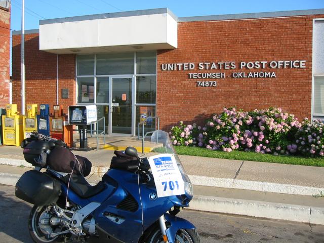
After leaving Hope I went into Oklahoma and caught the Oklahoma
Turnpike up towards I-40. I then continued west on I-40 until I got
to the exit for Tecumseh where I
picked up a T.
After I left Tecumseh, I made my way to Oklahoma City and managed to
negotiate my way through traffic to the site of the Oklahoma City
Memorial right as the sun was beginning to set. I pulled out my
35MM camera and took a few photos of the memorial before hopping on my
bike and making a run to a Days Inn on the west side of town.
While at the hotel I checked with a friend of mine, Sean, who was also
headed to the national with his father. They were about a day behind
me in Missouri, but we made tentative plans to get together somewhere
out west.
I went to sleep with 738 miles for the day and 1275 for the trip.
There were lane closures on I-40 around MM 170 which slowed down
traffic, but I had a pretty good day for only about twelve hours of
riding.
Sunday, June 19
When I woke up I felt like absolute hell. My sinuses were blocked up
and my throat was sore, and to top it off my ears were plugged and
hurting.
I actually had a moment or two of doubt about whether I would be able
to complete the trip, but I popped a few Advil and drank some coffee.
I also spent ten minutes fixing the electrical short in the power lead
to the starcom.
While enjoying the continental breakfast I struck up a conversation
with a guy named Dan from Nashville. He and his wife were just
starting a five week trip, beginning in Santa Fe, which is supposed to
end at the BMW MOA rally in Lima, OH. He was on a KLR, and his wife
is on an F650GS, and it sounds like they're going to have a ball.
Since they mentioned they were heading to the Colorado area anyway, I
invited them to the national in Montrose.
After a nutritious breakfast of a donut, two cups of coffee, a glass
of OJ, and a bagel, I hopped on I-40 and worked my way west towards
Albuquerque, with a planned stop in Adrian,TX. Once I started moving
my sinuses cleared up and I started feeling better.
The weather in Oklahoma was pretty lousy. Even though it was only
8:30, or so, when I got on the road, Oklahoma was hot, humid, and
windy. I really began to appreciate the effort it must have taken to
live in a sod house on the plains of Oklahoma before the invention of
air conditioning..
About seventy miles east of Amarillo, I stopped at a rest area to
answer a call of nature. When I got off the bike I noticed several
signs which said, "watch out for snakes." I've never seen a sign like
that before... The scenery at the rest area was pretty, so I broke
out the 35MM and shot some photos of the prairie.
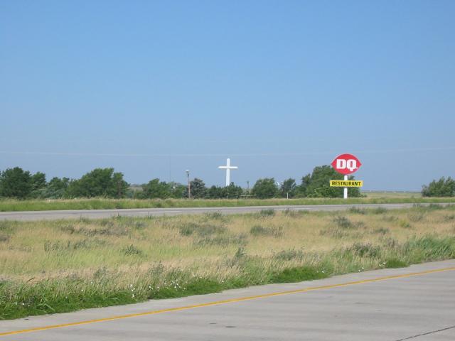
Texas is an odd place. In Groom, TX, they're proud of the largest cross in
this hemisphere, but I was more impressed with their DQ sign. In
Conway, they have gift shops which advertise that they have live
rattlesnakes you can play with.
Odd place indeed.
I made it to Amarillo around noon, and it was really starting to bake.
I grabbed a large Gatorade and water, poured some down my gullet and
the rest into my camelbak.
Ten miles, or so, west of Amarillo is a monument to Americana, the Cadillac
Ranch. I had no idea I would be passing it on this trip, but
because it's always been in my "if I get the chance to see it" file, I
pulled over when I caught a glimpse of it from the interstate.
The Cadillac Ranch has ten cars planted in the ground in the middle of
nowhere. It is one of those "whacky things" that only a few people
could appreciate.
I am one of those people.
I stopped at the ranch and pulled out the 35MM camera and shot about
half of a roll of film at the ranch. A visitor to the ranch who was
tagging one of the cars allowed me to get a photo of him doing his
work. After about thirty minutes, I was ready to hit the road.
In what is really a tragedy to American Nostalgia, the old Route 66
(U.S. 66) has been absorbed into I-40 through Texas and New Mexico.
But it still exist for little stretches, mostly for only a few miles
at a time, entering and leaving small towns. I decided to go ahead
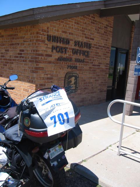
and get my kicks, and I stopped in Vega for lunch. After lunch, I
continued on to Adrian,TX where
I got an A.
When I crossed into New Mexico I began thinking about some of the
great American literature. More specifically I started thinking about
the Grapes of Wrath. I suppose the combination of wind, dust, and
heading west on Route 66 made it happen. In an amusing coincidence,
someone else who made it to the rally mentioned thinking about the
same book.
In my case, I started thinking about the Joad Grandmother, who died of
exposure. Thank god for Gatorade...
I stopped in Santa Rosa, NM for gas, and met a guy riding a 2005 FJR.
Those blue ones sure are pretty.
At any rate, he was on his way home to Houston from a rally in Las
Vegas, NM. We chatted for about fifteen minutes before going our
separate ways.
While riding along I-40, Eastern New Mexico is a lot like Western
Texas, boring and scrubby. However around MM 250 the scenery starts
getting better. Mesas, red rocks, and vermilion outcroppings dot the
landscape. But they're still few and far between..
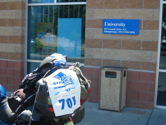
I made it into Albuquerque around 5PM, and worked my way to the University Post
Office where I got another A.
Right next to the post office was a used book store, and they had a
table with books for $1. I picked up two, but the shop was closed
with a sign saying they'd be back by 3:30. So, I slid $2 under the
door, and one of my business cards with a note explaining which books
I'd taken and to email me if I owed more, then hopped back on the bike
and took off.
I had some time to kill, and I knew that Monday would be a "down day"
so that Sean and his father could catch up. I rode over to the
Petroglyph National Monument, and then found a Super 8. When I
checked into the hotel I had ridden 558 miles for the day, 1833 for
the trip. The road closures on I-40 were in New Mexico between MM
305-300 and 275-265.
Monday, June 20
Since I knew my friend Sean was on his way, I decided to use Monday to
see some local sites I've always wanted to visit, and give them an
opportunity to arrive in Albuquerque. That meant Monday would be the
day I'd visit Chaco Canyon.
I left the hotel bright and early, around 7:30AM. I took I-25 north
to Bernalilo, and stopped for breakfast at the worlds most efficient
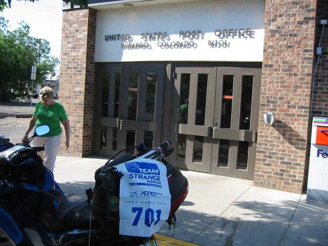
Mickey Dicks. After breakfast I continued on 550 towards Durango, CO
where I got a D.
The morning air was quite cold in the desert, and I was pissed at
myself for not wearing my heavy gloves. However, I knew it would be
warmer in the afternoon, and catching the sunrise in the Zia
reservation more than made up for the discomfort of the cold. The red
mesas glowed as they were struck by the first light of the day.
After gassing up in Aztec, I continued onto Durango and got my D. I
then worked my way west on 160 to 140 South, and followed that to 574
back to Aztec.
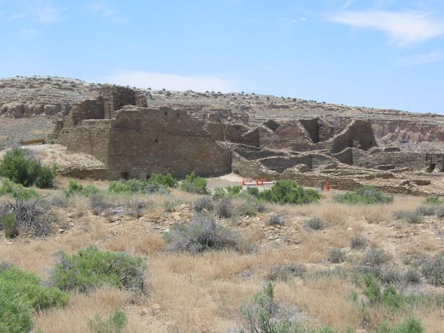
When I returned to Aztec, I stopped at the Aztec ruins, which are
really Anasazi ruins. I hiked the trail then made my way back to 550
headed towards Chaco.
There are two entrances into Chaco, a northern entrance off of 550,
and a southern entrance off of 57. I took the northern entrance,
which consists of 5 miles of asphalt and then 16 miles of dirt.
The dirt road (7950) was heavily rutted in some parts, and quite sandy
in others. I started out doing between 35 and 40 until I hit the
first very loose sand patch, and then decided going slower was
better.
When I was half-way through the road I came across a guy using a plow
to smooth out the road. The problem was that in order to pass him, I
had to cross over a furrow of sand he left in the center that was
about 18" deep. I worked my way through the sand, got around him,
then worked my way through only getting caught in the loose sand once.
Even with the road conditions, I still managed to make it to the park
about 45 minutes after pulling off of 550. Not bad, but I was
starting to feel a little tired and my bike was close to over-heating.
I checked into the visitors center, and took off for a little hike in the ruins. However,
the combination of the head cold, the heat, and the altitude got the
better of me and I decided to sit down and rest for a few minutes.
While getting ready to leave I ran into two guys on enduros who had
come in from the southern exit. By their description, it sounds like
that is the better way to enter and leave the park, but I decided to
exit via the way I came. After running the loop through the park, I
hopped back on 7950 and made my way towards 550. This time it took me
45 minutes just for the dirt, but I was proud that I made it back onto
terra firma without spilling the bike once.
I refilled my camelbak with more water and Gatorade, then stopped in
Cuba for gas. When I arrived back in Albuquerque at 6:15 it was 102F.
Sean and his father arrived fifteen minutes later.
Total mileage: 508/2341.
My journal has this one note at the end: "Although I'm not really
religious, anyone who doubts the existence of God needs to spend time
in red rock country."
Tuesday, June 21
I woke up very sick with a hard time breathing. It seems that the
exertion from the previous day moved my head cold into my chest.
Not good.
We got a late start and left Albuquerque around 9:00AM. We took I-40
west to Gallup then US-491 north to 264. US-491 used to be known as
US-666, but about two or three years ago someone got their shorts in a
wad over having a highway with "the devils number" so we renumbered
it.
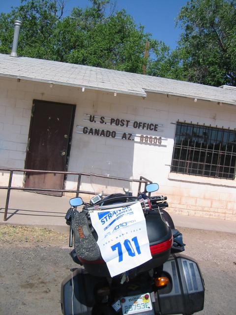
Once on 264 we continued west to Ganado, Arizona
where I got a G. 264 was interesting, running us up to about 6500'
through some forests. I saw a coyote running along the side of the
road..
After our photo op, we hopped on 191 north to Arizona 59. 191 ran
along the top of a ledge and was very windy. 59 ran through the
middle of nowhere, but parts were quite pretty as we passed through
red canyons and cliffs.
We took 59 all the way to the end, and then continued on into Kayenta
where we stopped for lunch at The Blue Coffee Pot. We were pretty
much the only tourists in TBCP, but the chicken salad sandwich was
delic.
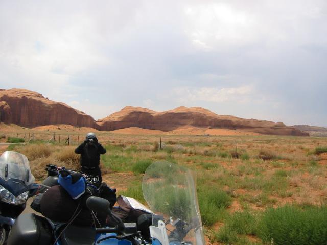
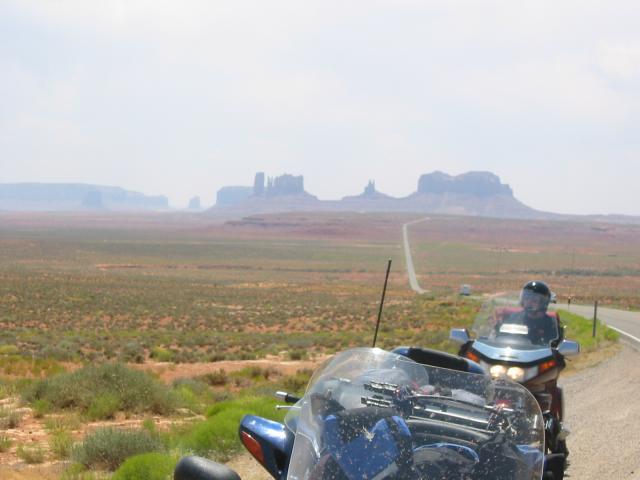
After lunch we went through Monument Valley, where Sean and I played a
round of dueling
cameras. With temperatures over 100F, it was really hot, but just
when we felt like complaining we came across a group of bicyclists who
were riding from San Diego to Atlantic City as part of the Race Across America. Heck,
I figured if they could continue to sit there and peddle, the least I
could do is work the throttle.
After Monument
Valley we continued on 191 up towards Monticello. Just south of
there we were stuck in traffic as there is road construction at the
"Devil Overpass". While in traffic we met two guys from Arizona,
Rodge and George, who were also headed to Montrose for the ST.N
national. Rodge was on an ST3 and George a K1100RS.
We chatted a bit, and then when traffic opened up we stayed as group.
However, in Monticello they pulled off to get a room while we worked
our way up the Abajo mountains to the Canyonlands Overlook.
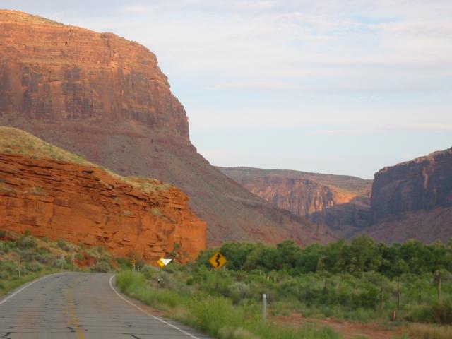
After the Abajo, we worked our way to Moab. When we arrived in Moab I
decided I needed to find a drug store and get something for my chest
cold. I also wanted to make an appointment at a clinic to make sure I
was healthy enough to continue the trip.
I picked up some Robitussin caplets because I wanted the expectorant,
and made an appointment at the clinic for 8:40AM local time the next
morning.
We managed to get the last rooms at a Super 8, and I picked up an M before we had
dinner at the Poplar Place. I had the lasagna and a Guinness, and it
was as good as I remembered from the last time I breezed through Moab.
Mileage: 485/2826.
Wednesday, June 22
I woke up feeling better than I had in two days. Although the
Robitussin seemed to be working, I still wanted to get a professional
opinion.
Because we had time to kill, we decided to hit 128 as the sun
was rising. I rode with Sean and Pat (his dad) for the first 25
miles, then I turned back so I would catch my appointment while they
followed it to I-70.
I arrived at the clinic a few minutes early, but I used the
opportunity to fill out the various forms that doctors invariably have
for you. I explained to the doc that I was about 2000 miles from
home, on a motorcycle, and that I intended to be home by Saturday.
She said that my chest sounded clear, and that it seemed like the
Robitussin had done some good. She offered to write me a prescription
for a steroid, but that in her opinion I was probably over the worst
of it and as long as I paid attention to myself I'd be fine for the
return trip.
She also recommended taking Wednesday off, just to give me a day to
catch some rest, and she warned me that I may have a relapse shortly
after arriving home just from the exertion. I told her we were only
heading to Montrose, and then I would take the rest of the day off,
and she said good.
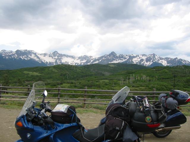
We left Moab around 11:30AM (EST), and headed south to 46, which we
took to 90, then 141 to 145 to 62 and finally 550. The 46/90
combination was really fun, with some nice switchbacks around the
state line. 141-145 were OK, but it rained on us for about ten
minutes. 62 was absolutely gorgeous, and we stopped to get a few
photos. Once we were on 550, we got stuck in traffic, but we
still managed to make it into Montrose by about 3:30 (EST).
I got to meet up with some old friends, and make some new ones. I put
some faces together with screen names, and had a beer. I had dinner
again with Mary and Mike, and made plans to have dinner with them next
year in Virginia. Then, I sat in the hot tub in my room for fifteen
minutes, then went to bed.
Total mileage: 220/3046.
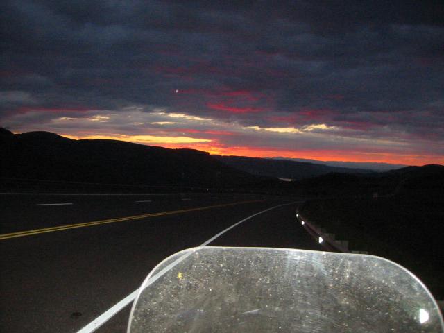
Thursday, June 23
The gods were smiling on me this morning, because when I woke up
bright and early I felt better than I had in a week. Because of how
good I felt, I decided to skip the Robitussin, which would also give
me a better gauge of how my body was doing. I packed up the bike,
checked out of the hotel, and hit the road by 7:10AM (EST).
I headed east on US-50 towards Gunnison. Aside from a brief stretch
where 50 is now a dirt road, approximately 5 miles east of Montrose,
the route was perfect. I passed through the Blue Mesa area as the sun
was rising and caught one of those perfect sunrises
you're lucky to see.
In Gunnison I stopped for breakfast and talked with a few people who
were doing Ride the
Rockies. After breakfast I spoke briefly with one of the staff
and asked if it was a tour, or a race.
"Well, it's a tour. But some people just can't help themselves, and
to them it's a race."
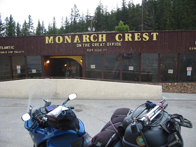
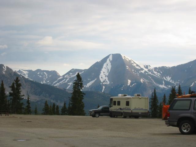
Because it was getting cool, I decided to put my jacket liner on and
continued west on 50 over Monarch Crest.
The elevation might have been high, but the view was
perfect.
Before I got to Canon City, I saw a woman painting landscapes along
the Arkansas River. I stopped and asked her if she minded being a
subject for me, and she agreed, so I shot about half of a roll of
film.
The canyon which she had turned into a studio was stunning, red rock
walls with green vegetation covering everything. Afterwards, I
continued on 50 east towards Canon City.
By this point in my trip I had forgotten about how some people can be
assholes, but while I was getting gas I was reminded that not everyone
is pleasant. Oh well, I wasn't going to let a dickhead ruin my trip,
and I shrugged his comments off as I continued towards Salida and Pueblo.
The route from Montrose to Salida is quite pretty and hilly, but from
Salida to Pueblo Colorado becomes a prairie. There were lots of deer
along the prairie, and in Pueblo I saw military jets performing
maneuvers.
Outside of Pueblo I hopped on 96, which crosses from Colorado into
Great Bend, Kansas. Within fifteen miles of Pueblo there were four or
five prisons on 96, but after that not a heck of lot else. There was
very little traffic on the road, and I started playing a game of
counting how many minutes it took before I saw another vehicle.
Most of the time I saw a car within three minutes, but I hit ten
minutes at one point.
In Colorado I also saw a large number of cyclists with their bikes
fitted with panniers and/or trailers. They looked like they were
doing a cross country trek, but they were spread out too far to be
part of the same group.
While riding through this region my mind was able to visualize how the
prairie must have looked, with bison running free, even just 150 years
ago.
Crossing into Kansas was a night and day experience for me because
although eastern Colorado had the same flat grasslands, it lacked the
wind that Kansas had. The wind was horrendous, it blew my face shield
up several times, and kicked up dirt and dust from all of the farms
reducing visibility.
I stayed on 96 into Great Bend, then hopped on US-56 to 150, and
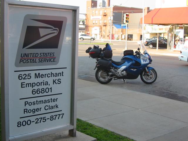
eventually made my way back onto US-50. I took US-50 into Emporia, where I
got an E.
I stopped for dinner, then called my wife Sandy, then Sean and Pat to
let them know I was alive, and then my friend Josh to confirm our
plans to get together Friday night. After dinner I took I-35 to
Ottawa, Kansas where I got a room.
Although I still felt great, I decided to get to bed early because I
knew I had a long day ahead of me.
Mileage: 751/3797.
Friday, June 24
I once again got an early start. After checking the tires, and
finding the rear down about 2psi, I topped it off and started on my
way to 

